HURRICANE MICHAEL: Landfall expected Wednesday afternoon
Published 8:41 am Wednesday, October 10, 2018
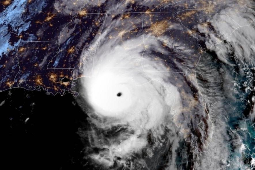
As expected, Hurricane Michael continued to intensify as it tracked north towards the Florida panhandle Tuesday night into Wednesday morning.
The storm developed into a category 4 hurricane late Tuesday night and is now sustaining winds of 145 miles per hour as is comes within six hours of landfall near Panama City Beach.
Herb Reeves, interim EMA director, said the increase in wind speed is the most significant development to happen overnight.
“Right now we’re still looking like we’ll have sustained winds of 25 to 30 miles per hour with gusts up to 50 miles per hour. We can expect between 2 to 4 inches of rainfall.”
Reeves said the storm is still expected to turn east at some point before it makes landfall, putting Pike County further on the “good side” of the storm. However, that eastward turn has not yet begun, and any westward shift in the track could bring significantly greater danger in Pike County, he said.
“If you’re not prepared yet, you need to do that now,” Reeves said. “There’s still a little bit of time left, but not much.”
Reeves said he expects the most significant weather impacts in Pike County to come in the afternoon after Michael makes landfall.
Trojan Arena is operating as the Emergency Operations Center for Reeves and other EMA and law enforcement officials to monitor the storm. It has also been opened up as a medical needs shelter for Pike and surrounding counties.
Local schools and government offices are closed today due to the weather, and trash pickup across the county has been rescheduled for Thursday. Utility workers and emergency responders are on standby to restore power, remove downed trees and assist anyone injured or in need of help during the storm.
More News


SportsPlus
Braves vs. Phillies: Betting Preview for August 31
Atlanta Braves (74-61) will play the Philadelphia Phillies (79-56) at Citizens Bank Park on Saturday, August 31 at…
How to Watch MLB Baseball on Saturday, August 31: TV Channel, Live Streaming, Start Times
The Los Angeles Dodgers versus the Arizona Diamondbacks is a game to catch on a Saturday MLB slate…
How to Watch the WNBA Today | August 31
Today’s WNBA slate includes just one game — the Connecticut Sun against the Washington Mystics. The WNBA is…
WNBA Betting Picks: Saturday, August 31
Wondering how you should bet on today’s WNBA game? Look no further. Below you’ll find computer predictions on…
Alabama State vs. North Carolina Central Predictions & Picks: Odds, Moneyline, Spread – Sunday, September 1
Which team is going to emerge victorious on Sunday, September 1, when the North Carolina Central Eagles and…
-
Polls
 Loading ...
-
-